

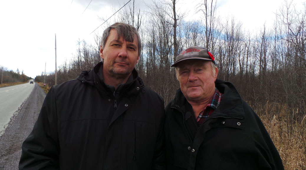
(ABOVE: Michael Erland (left) and Mike Westley, neighbours on Flewellyn Road.)
EDITOR’S NOTE: Stittsville is in the midst of change. What was once a small town community that was a gathering place for area farmers is now developing at breakneck speed. As residents adjust to this growth, so too must the natural environment of the area.
One of the notable changes is to the region’s network of streams and wetlands. Landowners with property just west of town have seen a rise in the amount of water on their land during a period that has coincided with Stittsville’s expansion.
Wetlands have been described as “a lung of the earth”. They play an important ecological role but are constantly in flux due to a variety of natural and human causes. For the past several weeks I’ve been interviewing a variety of landowners, experts and public officials to learn more about what’s changing the water in this area, and how these changes are affecting the environment and the community.
In Part 1, we meet Michael Earland and Mike Westley. They’re neighbours on Flewellyn Road and they’ve seen water levels steadily rise on their properties for years, to the point where parts of their land were identified as “Provincially Significant Wetland” (PSW).

***
MICHAEL ERLAND BOUGHT HIS 49-ACRE PROPERTY ON FLEWELLYN ROAD NEAR CONLEY ROAD IN 2002. He built his home there and planned to develop the eastern side of his land as a small residential community of about a dozen homes.
The water level has increased so much on his property that in 2005 it was identified as part of a new “Provincially Significant Wetland” (PSW), effectively halting any development or land use, and significantly reducing the land’s value. Property that was once used as pasture for cows is now home to ducks and beavers.
He tried to sell the land, but nobody wanted to buy it because of the PSW designation.
“As soon as people find out, they say ‘I’m not going near that’,” he says.
***
ERLAND’S NEIGHBOUR MIKE WESTLEY HAS OWNED HIS LAND SINCE THE 1970S. Westley says nearby land that he used to be able to drive across can now only be crossed by canoe. He’s built a berm around his property to keep it from flooding.
Westley is the president of the Goulbourn Landowners Association. They released a position paper a few years back titled “Wetland Designation Problems” that details their objections to the PSW designation process.
His property was deemed PSW by the city at the same time as Erland’s, but he fought successfully to have the designation removed. Westley blames a recent heart attack on all the stress he’s endured during the process. He continues to work with other landowners to try to solve the water issue in the area.
***
WHERE IS ALL THE WATER COMING FROM? Erland and Westley say that whatever is happening with the water, it’s not natural. They put most of the blame on inadequate drainage infrastructure and ongoing quarry operations along Jinkinson Road.
There are several factors contributing to the increase in water. A city report from 2010 blamed “changes to subwatershed boundaries related to ditching on private property”, new residential development, aggregate resource operations (quarries), Highway 7 development, a gas pipeline, and “significant” beaver activity. Seasonal and yearly environmental changes play a role as well: rainfall, snowfall, and changing temperatures, for example.
Erland and Westley have been focused on PSW’s for nearly 10 years. Around 2004, a development proposal at 6851 Flewellyn Road triggered a review of all the land in the area. The development never went through (the city ended up buying the land for $1.00 in 2009), but as a result of the review, land on about 60 nearby properties was designated as PSW by the Ontario Ministry of Natural Resources.
Some of the landowners, including Westley, had their land re-evaluated and got the designation removed. A group of landowners along Flowing Creek on Fernbank and Flewellyn, including Erland, still have the designation on their property.
In 2006, Erland and Westley were among 19 area landowners to petition the City of Ottawa to build a municipal drain in the area that would ensure proper water flow and proper maintenance.
Over time, creeks and ditches tend to fill up with dirt, garbage and beaver dams that can impede water flow. The city is only responsible for maintaining ditches and culverts along roads and on other property that it owns. Most of Upper Flowing Creek and other watercourses in the area flow through private property, so it’s up to private landowners to ensure they’re kept clean. Some land has been abandoned, and some landowners are more vigilant than others about cleaning out the dams that pop up from time to time.
The municipal drain project would have created a city-owned drain through private the property. The original estimated cost for the work was around $250,000, but it skyrocketed to over $1.6-million for the drain, plus another $1.8-million for new culverts. Private landowners would have been on the hook to cover $1.2-million of that cost.
The landowners balked at the idea, in part because of the price tag, but also because they thought the city should bear all of the responsibility for the drainage infrastructure, given that the source of the extra water comes from areas further north.
(For more background on the debate over the municipal drain, you should read the minutes from this meeting in 2010.)
The municipal drain project did not go ahead. Instead, an agreement was reached to have the private landowners clean ditches on their own properties, and have the city maintain ditches and culverts on property that it owns along local roads. The city would delay formally designating lands as PSW in the Official Plan for five years, but establish a special “Flewellyn Special Study Area”. After five years, in 2016, the land in the study area would re-evaluated to see if it still qualified as PSW.

***

I MEET ERLAND AND WESTLEY ON A BRISK SATURDAY IN NOVEMBER ON JINKINSON ROAD. They take me on a tour of the area, making stops along Fernbank and Flewellyn to have a look at municipal ditches and culverts they say are causing a lot of the problems.
Erland says that while landowners have done their part and cleaned their ditches, the city hasn’t done enough maintenance on their infrastructure. Without proper maintenance, water will keep flooding his property, and prevent him from getting the PSW designation removed.
“They haven’t upheld their portion of the deal, yet the clock is still ticking,” he says.
He says culverts along Flewellyn are inadequate. “It’s not wide enough for water to pass,” he says.
A 2011 Ontario Municipal Board decision referenced a consultant’s drainage study that found “the original drainage area had increased from 75 hectares to 720 hectares through diversions of flow”, and that some culverts were sumerged, “demonstrating past better drainage and less standing water”. The study found that water pumped from quarries upstream contributes to the water flow, and channel obstructions downstream reduced the capacity of culverts.
Derrick Moodie, a manager with the city’s rural services department, says that the city has done work on the ditches and culverts over the past several years.
“In a perfect world, the municipal drain project would have gone ahead, and it would have resulted in an engineered solution from the top of the watershed to the bottom of the watershed. It would have ensured legal and adequate outlet,” he says. “From the city’s perspective there were drainage works done, even though they weren’t exactly the ones that were planned (had the municipal drain been approved).”
He says the city has no plans to make changes to the drainage infrastructure in the area, and says residents can call 3-1-1 to report issues. City crews will respond to requests on a case-by-case basis.
“Typically a municipal drain sets us up for being proactive on an ongoing basis. Without that municipal drain, we would be more on the side of the reactive, responding to concerns,” he says.”To revive the municipal drain would be something that we would be looking to the residents to take on.”
Westley says the landowners have no interest in petitioning for a municipal drain unless the City is ready to cover the costs.
“The property owners are not the problem,” says Westley. ”The property owners do not create the water. They have the water being dumped onto them.” He’s referring to the various factors upstream – quarries, Highway 7, residential development – that he says are sending more water towards property in the south.
For the past few months the City has been using sensors to monitor water levels at eight locations along creeks, streams and ditches in the area. Measurements are taken in 15 minute increments, and the data will be used to create a hydrological model of the area.
Once analysed, the data will be part of a report to be presented at a public meeting in early 2015, according to Dr. Nick Stow, a biologist with the City of Ottawa.

***

ERLAND INVITES ME TO VISIT HIS PROPERTY. “Bring your rubber boots,” he says.
When I arrive he is exhausted. He just cleared another beaver dam from the large creek that runs across the east part of his land. It occurs to me that he has a lot in common with beavers: he’s hard-working, stubborn, and persistent. He’s spent nearly 10 years organizing neighbours, attending public meetings, and writing letters to fight the PSW designation.
Good thing I brought my boots. The ground on his property is soaking wet. He shows me where 100-year-old maples once stood. They’re gone now. Erland needs hip waders to get to the dam further back on his property. No wonder beavers like it back here.
Despite all the bureaucracy he’s had to wade through on this file, he still thinks there’s a solution to be found.
“Of course I’m optimistic, of course it’s going to get solved,” he says. “It’s a human-made problem, so there’s a way to fix it.”
***
COMING UP IN THIS SERIES:
- Quarry Query: What effect do industrial operations on Jinkinson Road have on the Goulbourn wetlands?
- A Complex Situation: A 2010 report from Ontario’s Environment Commissioner identified several problems with the designation of PSWs.
- Poole Creek Problems: Culvert work along the Trans Canada Trail earlier this fall brought attention to ongoing issues in the area.
We’d like to hear from our readers on this issue. Add your comments below or email feedback@stittsvillecentral.ca